Views on the Northern and Western Coasts of Sutherland:a very scarce set of 22 aquatints by Elizabeth Leveson-Gower, the Duchess of Sutherland (1765 - 1839)
Nothing in my collection, I believe, is of more interest than this set of 22 aquatints by the Duchess of Sutherland, and I am delighted to be able to share them with you on this website. They are extremely scarce (the National Library of Scotland has only 8 of them, in with their Sutherland Estate Papers), and I didn't know of their existence until they came up for auction. My research into the far north of Scotland has led me to understand that early artistic images of Sutherland and Ross-shire are very scarce, owing to the difficulty of travel in the region, yet here are 22 handcoloured prints of scenes as inconspicuous and remote as Melness Point, which happens to be a few hundred yards from the house to which my parents retired in the 1980s.
The aquatints were engraved by F.C. Lewis at 53 Charlotte Street, Portland Place. At the moment I don't know the exact date when they were published. The original invoice for the sale of this set in 1979 suggests they date c.1810, but the auction house from where I bought them dated the set c.1830. That would tie in with the information from the British Museum which suggests that F.C. Lewis gave his address as 12 Charlotte Street until at least 1827. The folio bears an inscription "To Wm. Mackenzie Esq., with the Duke of Sutherland's kind regards, 'S'." Willaim Mackenzie is a common name in the north, but one candidate for this presentation might be the William described in the Sutherland Estate Papers, volume 8, as a law-agent. He actually accompanied the Duchess on her tour of the North in 1808. If she made her sketches then, these images would pre-date those by William Daniell. I have never seen earlier representations of, for example,Ben Loyal than that by Daniell in 1820.
Clearly, I have much research to do on this set, and any information I receive I will add to this page. Should anyone reading this have knowledge to impart, I would be only too pleased to hear from them. In the meantime, I display the set below, with thanks to Chris McNeill for his additional suggestions on some locations.
The portfolio contains a sheet which identifies most of the locations of the prints. It is titled "Views on the Northern and Western Coasts of Sutherland", and it confirms at the bottom that they were "Drawn by the Duchess Countess of Sutherland, Engraved by Mr F.C. Lewis, Engraver of Drawings to the King. 53 Charlotte Street, Portland Place."
1. The Coast of Assynt from Meal Dearg, or the Red Lump.
Meal Dearg is a hillock of some 163m in height, to the NE of Polbain.
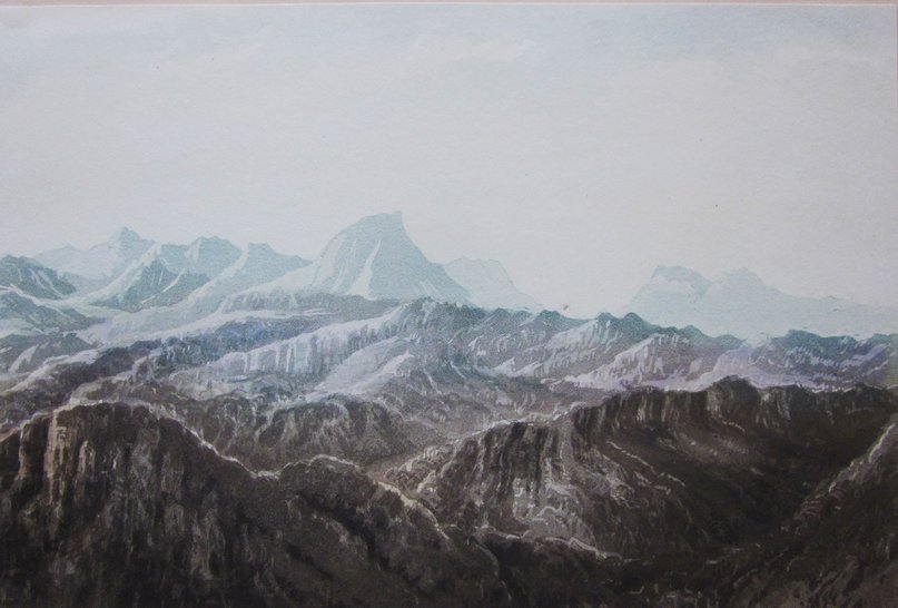
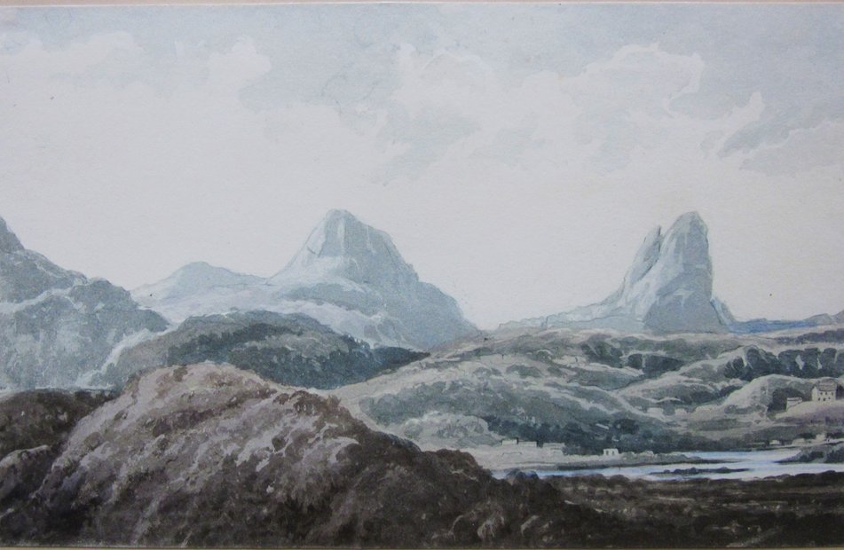
2. Funovin, Arkill in Reay Forest Stack in Reay Forest.
I don't think I have ever seen any 19th Century images of Foinavon or Arkle before this one. I suspect the geologists sketched them, of course. Ben Stack is in the middle, with Foinavon to its left, and Arkle to the right.
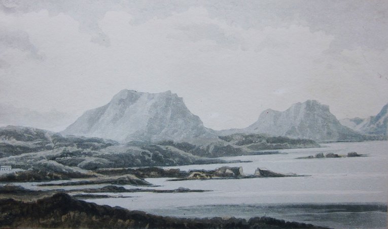
3. Cuniag Benmore of Assynt.
Quinag is depicted by Daniell, and appears in a number of 19th century images, often from Loch Assynt, but Ben More Assynt is a rarer subject-matter for artists. The exact location from where this sketch was made is not clear. If the mountain on the right is Ben More Assynt, then the location would have to be somewhere to the west for the mountain to be lined up that close to Quinag.
4. Canisp Sulven New Manse at Store
This is a classic view of Canisp and Suilven looking across the loch to Lochinver itself. The National Library of Scotland has a sketch map of Store [Stoer] Manse and Glebe dated 1829, which suggests the date of c.1830 is correct for these images.
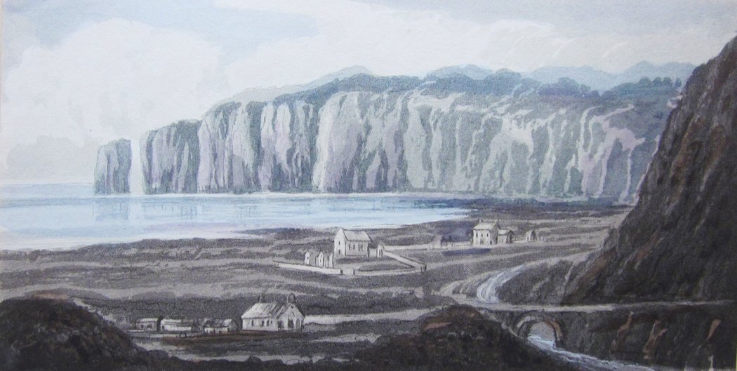
5.Church & Village of Store Clachtoll Pictish Tower Entrance to Loch Inver.
Coulmore in Ross-shire Broken Rock Coulbeg.
An early image of the Split Rock at Clachtoll. The "Pictish Tower" is the remains of Clachtoll Broch.
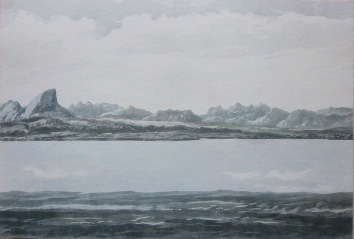
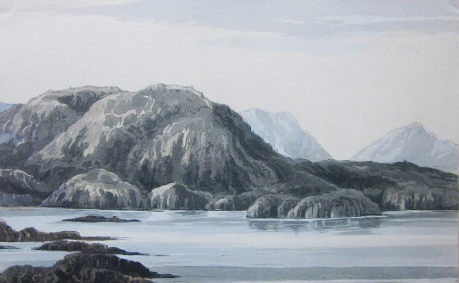
6. Stack in Coigach
Ross-shire.
A view of the Assynt mountains, but one that is a bit of a puzzle. Is the 'Stack' Stac Pollaidh, as seen across Annat Bay, or Loch Lurgain?
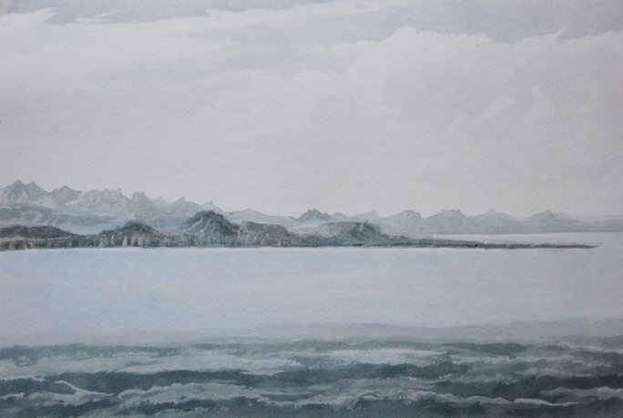
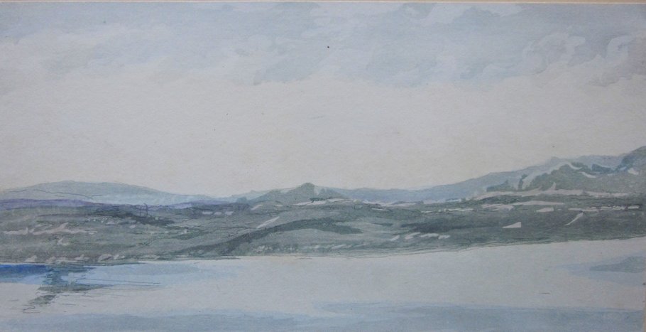
7. Entrance to Loch Broom in Ross-shire.
Point of Cogiach.
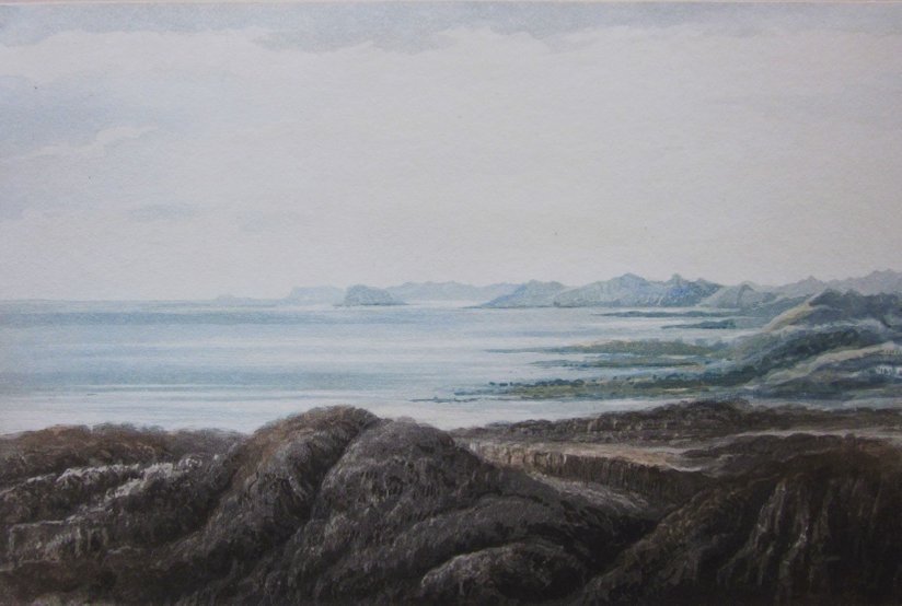
Three views of the distant Hebrides:
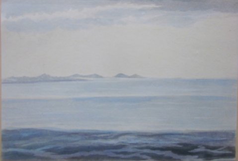
8. Gairloch Point Isle of Sky
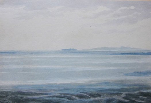
9. The Shiant Isles Island of Harris
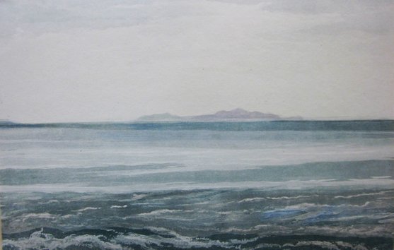
10. Island of Lewes [Lewis]
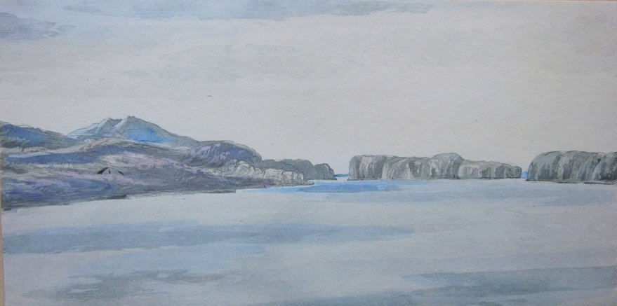
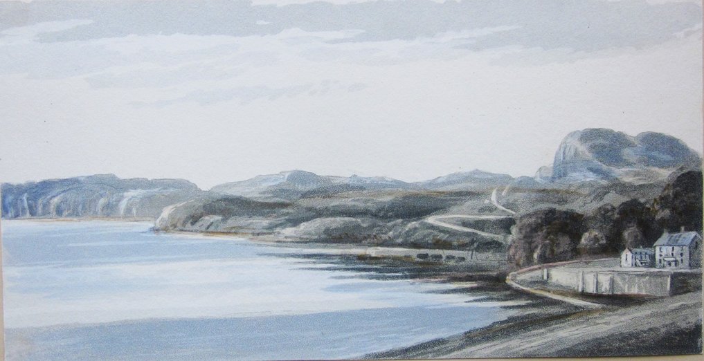
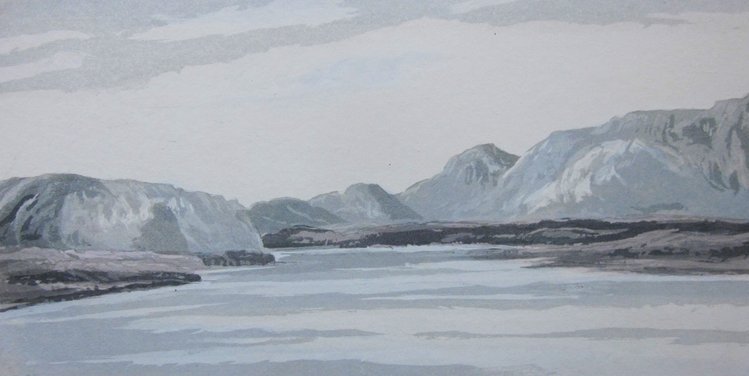
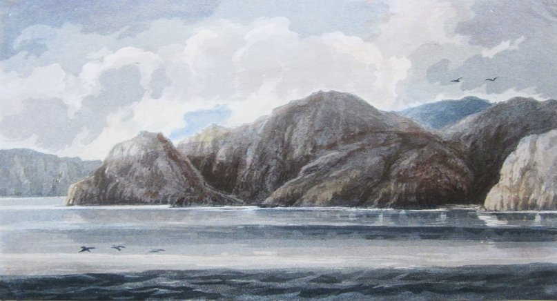
11. Point of Melness Rabbit Island Island Roan
Opening of the Bay of Tongue
Ben Hutig in the distance. The view is taken from the east side of the Kyle of Tongue..
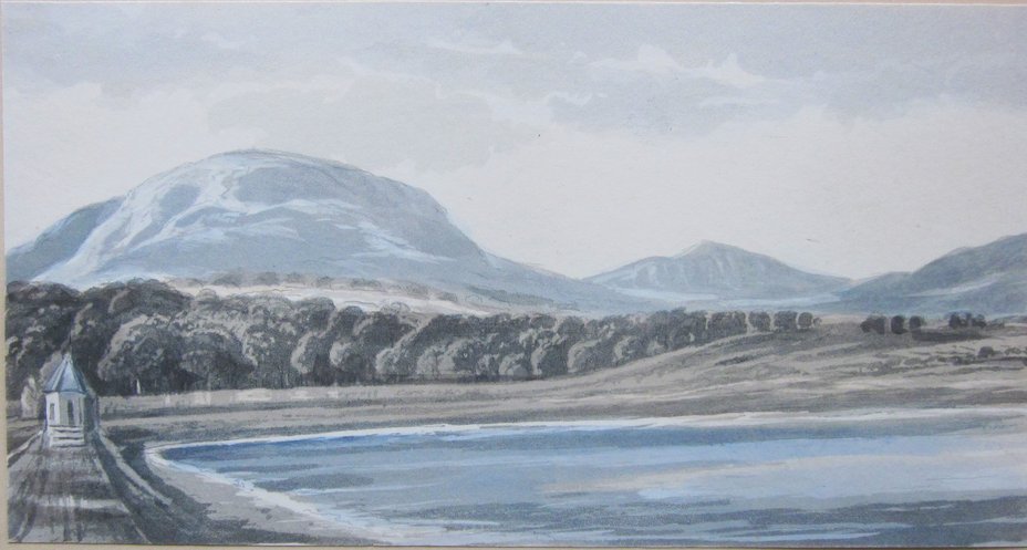
12. Bay of Tongue The Watch Hill
Tongue House
A view the Duchess would know well: Tongue House is part of the Duke's estate.
13. Point of Land Leading to the Ferry Tongue Plantations Farm
Ben Tongue
The "Point of Land" now leads to the causeway that crosses the Kyle of Tongue, and the little house now stands above the road.
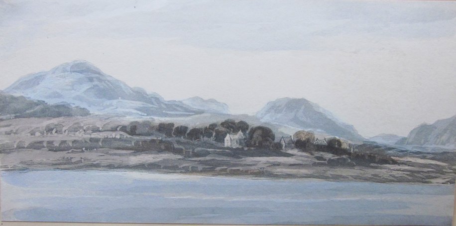
14. Church Manse & Village of Tongue
As seen from the Melness side of the Kyle.
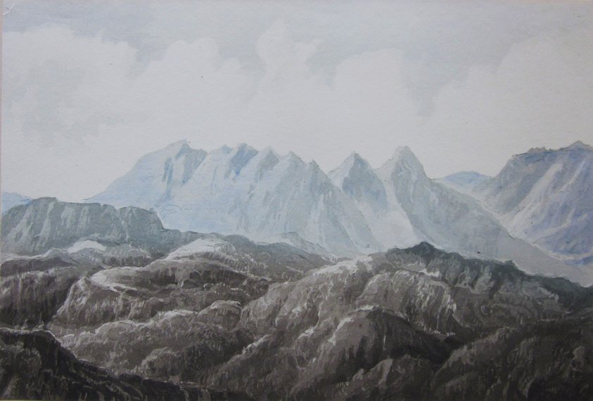
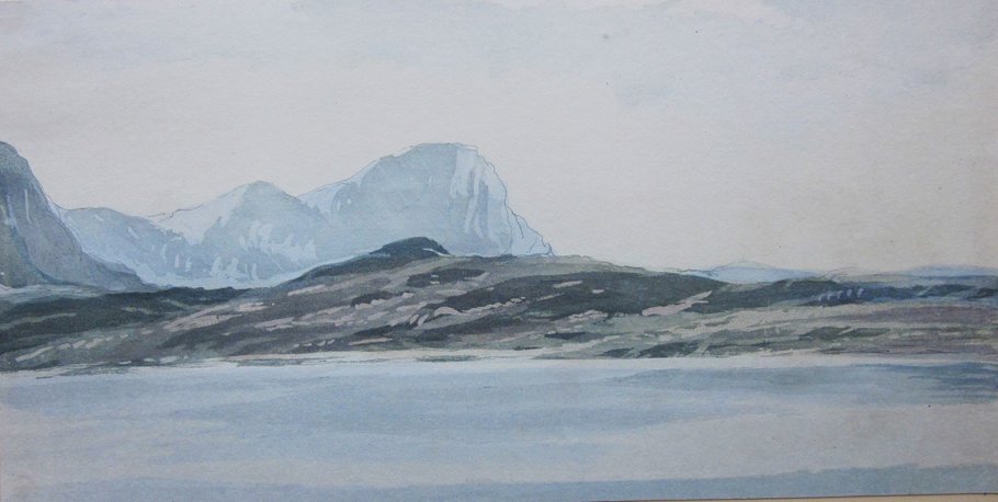
15. Ben Loyal Castle Varrock
Castle Varrich may possibly date from the 14th century. Ben Loyal, known as 'The Queen of Scottish Mountains' would undoubtedly have been painted a good number of times during the 18th and 19th centuries had artists been able to get there.
16. Untitled. I suspect it shows the southern end of the Kyle of Tongue, with the foothills of Ben Hope rising on the right.
17. Ben Hope The Moin
The Moine was a notoriously boggy bit of ground stretching from the Kyle of Tongue to Loch Eriboll. The Duke of Sutherland built a road over the Moine c.1830. Ben Hope is the most northerly Monro.
18. Ferry & Point opposite No. 3 [13] The Moin Melness
Bringing the View Round to the Opening of Bay, Joins No 1 [11]
The Duchess has provided a nearly complete view of the coast round the Kyle of Tongue.

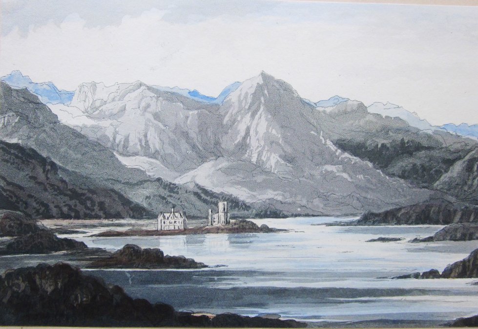
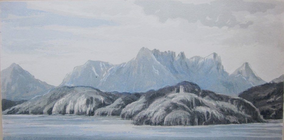
19. Loch Assynt
Cuniag Chalda House Ardvreck Castle Brebeck
The Benmore
A fine view of Loch Assynt, from the NW. Chalda [Calda] House is now a ruin. It was said to have been deliberately set on fire in the mid-18th century, but it looks to be in a complete state here. Ardvreck Castle is where the Duke of Montrose was held prisoner.
20. Loch Assynt
Shian Garve Island on which was the garden of the Laird of Assynt Canisp
or the Rough Hill
I have as yet been unable to find out anything about the Laird's garden. The mountain to the left of Canisp is probably Beinn Gharbh. The island in question might be either Eilean Dubh, or Eilean Assynt.
21. Entrance to Loch Row, on the Coast of Assynt
Probably Loch Roe,an inlet between Achmelvich and Lochinver.
22. The Church & Manse of Farr in Strathnaver
It appears that there are two churches in this image. The caption, I believe, refers to the further one, which is now the Strathnaver museum.