27. Feb, 2022
Rare Maps of Sutherland
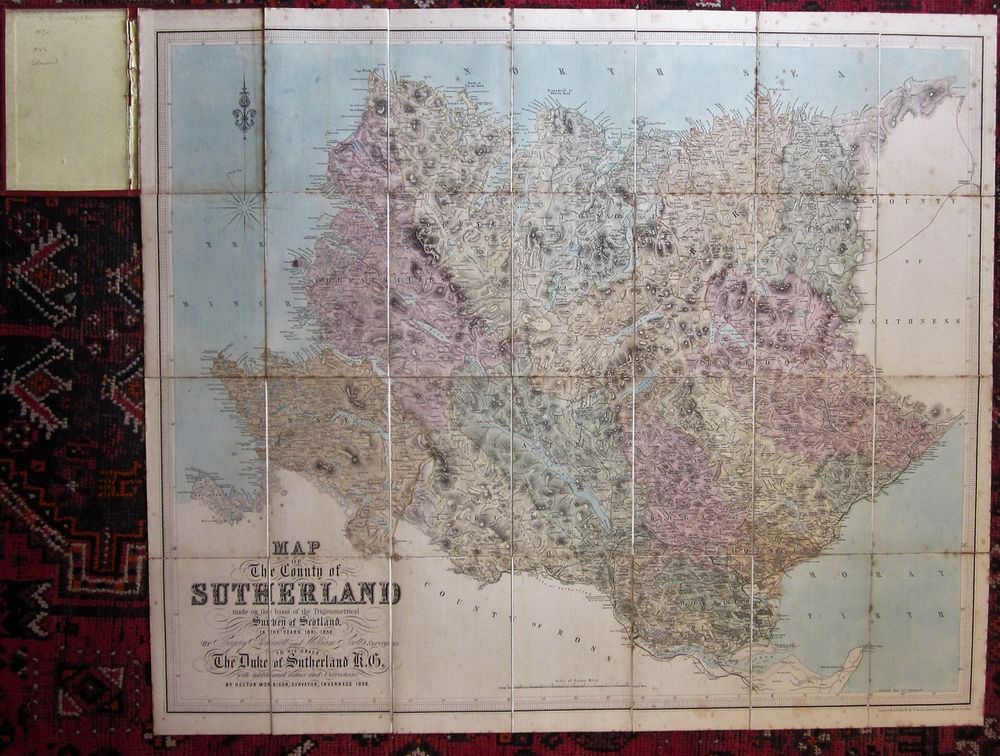
As late as the 19th century, visitors to Sutherland were few and far between because of the difficulty of access. This also meant that the county had to wait for a long time before there was a full cartographic survey. Where detailed surveys of areas like the Lothians began in the 1740s, the first full survey of Sutherland was completed in 1832, and published in a map by Gregory Burnett and William Scott in 1833. The coastline of the far north had been corrected as early as 1744, in Bryce's superb map, about which I shall soon post a page. Otherwise, the county remained unexplored, and according to the list in Moir's Early Maps of Scotland (Vol II, 1983), there were relatively few maps depicting the region. I don't have in my collection all these maps, but I have a good selection, and have posted a page on rare maps of Sutherland. I remind you of the excellent National Library of Scotland website where you can explore many of these maps in greater detail than I can manage.
The map shown above is the second edition, 1853, of Burnett and Scott's Map of the County of Sutherland.
With thanks for visiting my website, Alastair.