France and Scotland: The Ignorance of Some French Cartographers.
Map-making in France during the 17th and 18th centuries has an impressive reputation. As the influence of Holland as a maritime power decreased, so that of France increased, with families like the Sansons, and the Cassinis producing maps "noted for the elegance of their engraving and in later years, when they were able to take advantage of new scientific mapping methods, for their clarity and accuracy." (Antique Maps, Moreland & Bannister, 1989). It was Cassini senior who pressed for a complete survey of France using triangulation in the later years of the 17th century, and it was his son Jacques who began such a survey in the mid-18th century, well before any such project had been initiated in England.
But when one looks at their maps of countries beyond their shores, it would be a mistake to think that France was at the forefront of cartography at that time. Here, for example, is a world map by Nicolas de Fer, from his Introduction a la Geographie published in 1717. Australia is emerging tentatively, which is fair enough given that it had not yet been explored in detail. But over in North America, California is depicted as a large island - an island that dominates the west coast on his detailed map of the American continent found later in the book.

World map by Nicolas de Fer, 1717.

Detail from de Fer's "l'Amerique Meridionale et Septentrionale". His Isle de Californie fills much of the west coast of North America.
Admitedly, maps showing California as an island continued well into the 18th century, but news was reaching Europe as early as 1701 from reports by Jesuit missionaries such as Eusebio Kino, that California was in fact a peninsula.
When it comes to Scotland, these inaccuracies continue.
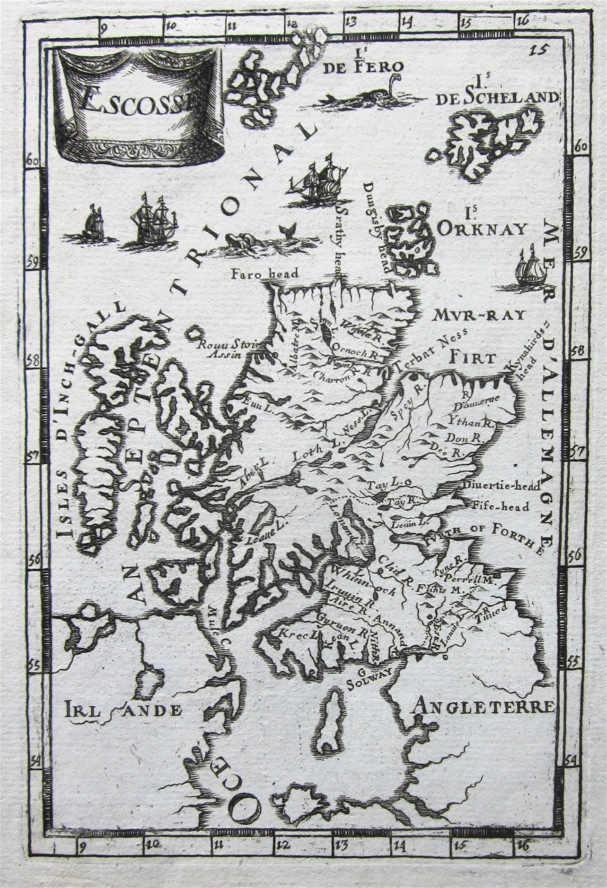
One would not expect an accurate map of Scotland in the 17th century: it simply did not exist anywhere. But this map of the country by Alain Manesson Mallet, one of several published in his Description de l'Univers in 1683, makes little attempt at a correct depiction of the north coast as it was then known. Strathy Head is shown as the most northerly point, and the various Kyles seem to have been inserted in a random fashion. Remarkably, whilst other maps of this period were excluding the Cape Wrath headland completely, Mallet here inserts a prominent but unrecognisable chunk of land on the NW point, but he labels it Faro Head.
Let us now fast forward to the middle of the 18th century, a time when in France serious efforts were being made to map accurately its own country using triangulation, and when in Scotland, Alexander Bryce had published in 1744 his accurate map of the Scottish north coast. English map-makers, such as Emanuel Bowen, adjusted their maps of Scotland immediately once Bryce's information had been published, but they went unnoticed in France, apparently.
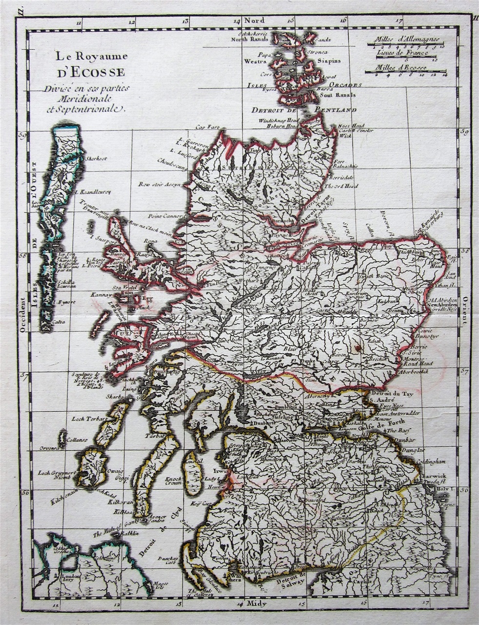
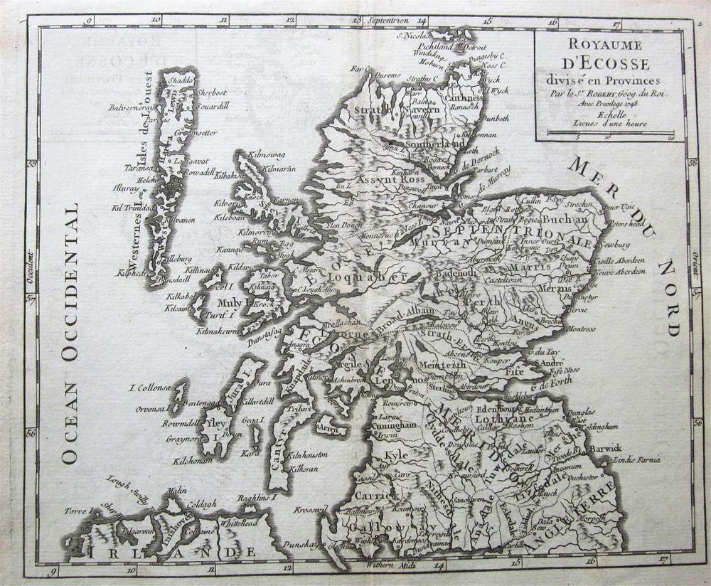
These are two maps published in France in 1748. The one on the left is by George Louis le Rouge, issued in his Atlas Nouveau Portatif. The other on the right is by Robert de Vaugondy, again in an Atlas Portatif. Four years have elapsed since Bryce's map was published, but still they continue with an old shape that excludes Cape Wrath all together.

Detail from George le Rouge map "Le Royaume d'Ecosse" showing the north coast lacking the Cape Wrath headland.

A detail from the de Robert de Vaugondy map of 1748, again lacking the Cape Wrath headland.
Worse errors follow as the century unfolds. In 1750 Dorret published his landmark map of Scotland which further corrected inaccuracies found in the shape of the coastline, not least in the islands.
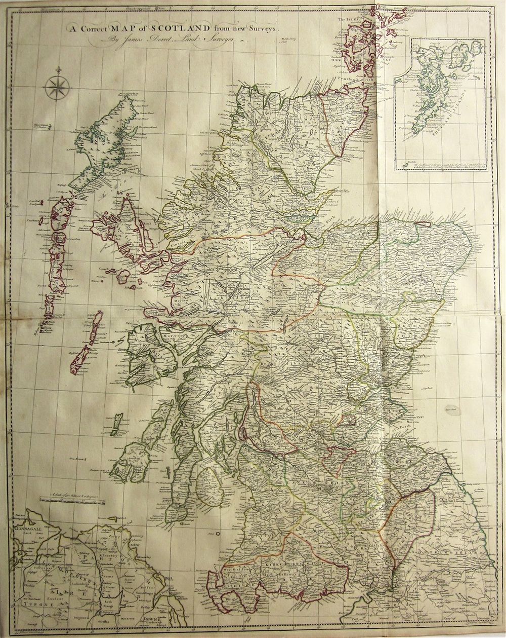
"A Correct Map of Scotland from New Surveys." An edition of James Dorret's superb map originally issued on 4 sheets in 1750, this a reduced version published April 30th, 1751. The outline of the coast was a huge improvement on previous maps.
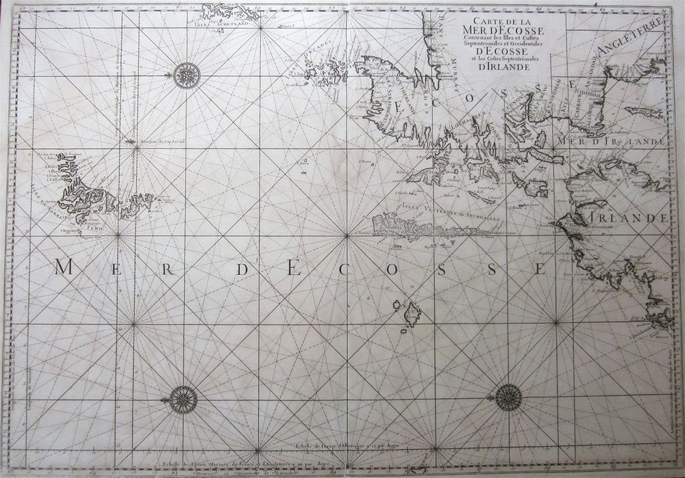
This large map of the coast and islands of Scotland by J.N. Bellin was, according to Moir (Early Maps of Scotland, 1983) published in 1764. David Rumsey, on his website, has an example dated 1773, Yet still Bellin persists with the old design, without the Cape Wrath headland, and ignoring Dorret's improvements.

Detail from Bellin's "Carte de la Mer d'Ecosse...." published in 1764.
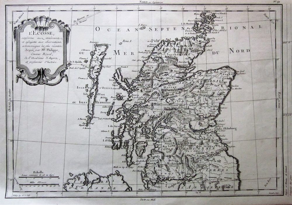
Later still, in 1770, Mr Philippe ("Censeur Royal de l'Academie d'Angers et Professeur d'Histoire") published this map in his Atlas Universel. The shape and details on this map is really no omprovement on maps published 200 years earlier.

Detail from Mr. Philippe's map of 1770.
For a country that was at the forefront of cartography in some areas, it seems that the general awareness of many of their map-makers was a little blinkered.